Although most of the land surrounding San Diego Bay is under the jurisdiction of public agencies, approximately 125 acres just south of the Sweetwater Marsh National Wildlife Refuge is privately owned.
There have been many proposals to develop this land, the most recent beginning in 2002. The City of Chula Vista gave Pacifica Development Cos. the right to develop the property and they submitted a plan for a high-density housing project called the Bayfront Villages. This proposal included 3,400 housing units in 20-story high rises.
Environmental Health Coalition's 10-year community organizing and advocacy efforts have led to the creation of a Chula Vista Bayfront Master Plan that protects the Sweetwater Marsh and greatly reduces the density of development. This will be accomplished through a land swap between the San Diego Port District and the City of Chula Vista.
Background
When Environmental Health Coalition learned of the proposed development, we immediately recognized that this high-density project didn't belong there and started our "Don't Pave Paradise" campaign. In December 2002, a special public meeting was called by the Chula Vista City Council. More than 400 people attended, universally opposing the project.
In January 2003, Pacifica revised its proposal (and changed the name to Bayfront Commons), reducing the number of units from 3,400 to 2,000. Still, this was the wrong proposal for such an environmentally sensitive location. Around same time, the Port was developing its Master Plan for the adjoining Port controlled property. The idea of a land swap between the Port and the Pacifica surfaced at the December hearing. This would allow the developer to construct housing on property further away from the Wildlife Refuge.
Community-driven land use planning
EHC used its community-driven land use model to develop a vision for the Chula Vista Bayfront. It formed a Chula Vista Community Action Team, provided the CAT members with education and resources to develop a vision, actively organized support for the vision, and developed an implementation and monitoring plan. Unlike EHC's other local community planning efforts, the Chula Vista bayfront currently doesn't have a residential section, so members of the CAT were drawn from other Chula Vista neighborhoods. The Bayfront Master Plan was seen as an opportunity to turn the area into a city-wide resource.
Step 1: Create the vision. EHC hired Doug Coe, the director of the San Diego State University Research Laboratory, to conduct a community survey to discover Chula Vistan's view on the development project. The results were released in April: an overwhelming majority of Chula Vista residents opposed high-density housing at the site and showed an overwhelming preference for low levels of development.
EHC's Chula Vista Community Action Team then developed its criteria for bayfront development:
- Protect wildlife
- Improve quality of life
- Employ sustainable development principles
- Be low density
- Create good jobs
- Include appropriate recreational opportunities
- Focus on transit, not roads
- Preserve the view of the Bay
- Protect air and water quality
- Use the natural beauty of the area as a focus
- Link to other regional development efforts (Port to south, national city to north, city core to east)
Step 2: Convert the vision into a land use map. The Community Action Team worked with a professional land-use planner to create a map reflecting their vision.
Step 3: Gain community support. From letter writing campaigns to house-to-house canvassing, EHC kept the community informed and involved in the process.
Step 4: Get the process started. In May 2003, EHC published a letter to the editor endorsing joint planning of City and Port for both pieces of property, and in March 2004 the Port, Chula Vista and Pacifica begin a joint planning process.
Step 5: Incorporate the vision into the elements of a new Community Plan. The City and Port established a Community Advisory Committee. The CAC supported a plan that closely reflected the vision developed by the Community Action Team.
Step 6: Gain support of local city council representatives. In March 2004 the Port, Chula Vista and Pacifica begin a joint planning process and in 2004 they approved the Community Advisory Committee's recommended plan.
Step 7: Be persistent. Although the plan was approved in 2004, the difficulties surrounding the land swap greatly slowed down implementation. In 2010, in order to facilitate implementation of the plan, a {tip coalition of environmental and community organizations::Environmental Health Coalition, San Diego Auduon Society, San Diego Coastkeeper, Coastal Environmental Rights Foundations, Southwest Wetlands Interpretative Association, The Surfrider Foundation-San Diego Chapter, and Empower San Diego}coalition of environmental and community organizations{/tip} entered into a settlement agreement with the Port and the City spelling out the conditions for the land swap and future development. These include buffer zones between wildlife areas and development, creation of the South Bay Wildlife Advisory Group to advise in the creation of the Natural Resource Management Plan, and minimum design elements to reduce pollution and energy consumption
Step 8: Coming Soon! Celebrate adoption, but monitor implementation. The Plan and Final Environmental Impact Report are currently being reviewed by the California Coastal Commission. Environmental Health Coalition is a member of the Wildlife Advisory Committee and will continue to monitor the project and its impacts.
Copies of the Chula Vista Master Plan and other documents can be found on the Port's website at http://www.portofsandiego.org/chula-vista-bayfront-master-plan.html
 Environmental Health Coalition's efforts are mainly focused in communities but a glance at our
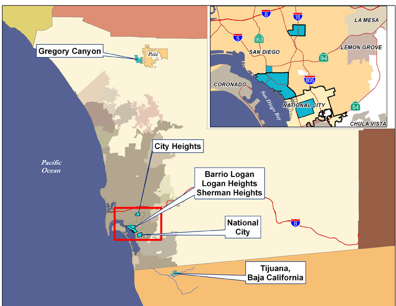
 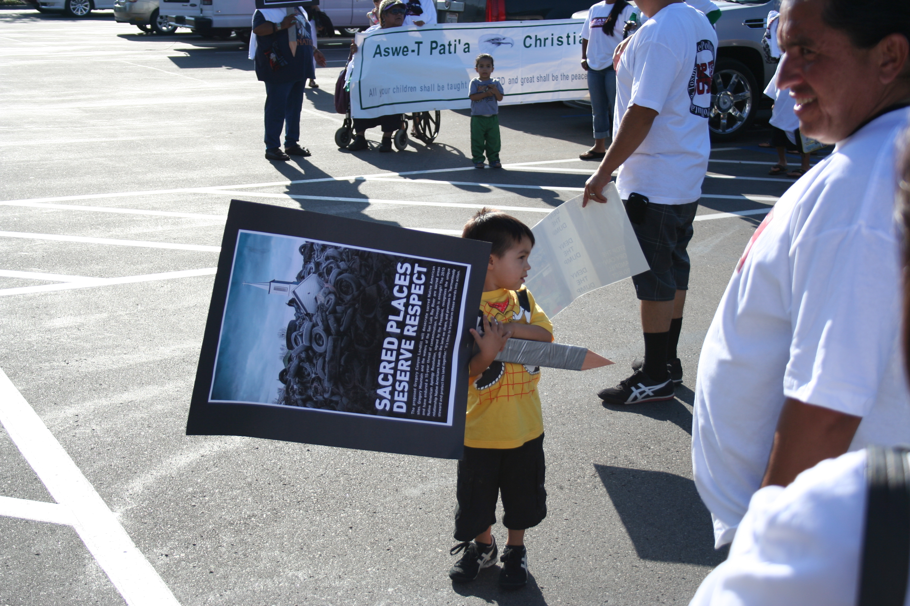 Environmental Health Coalition has opposed the construction of Gregory Canyon landfill for over a decade.
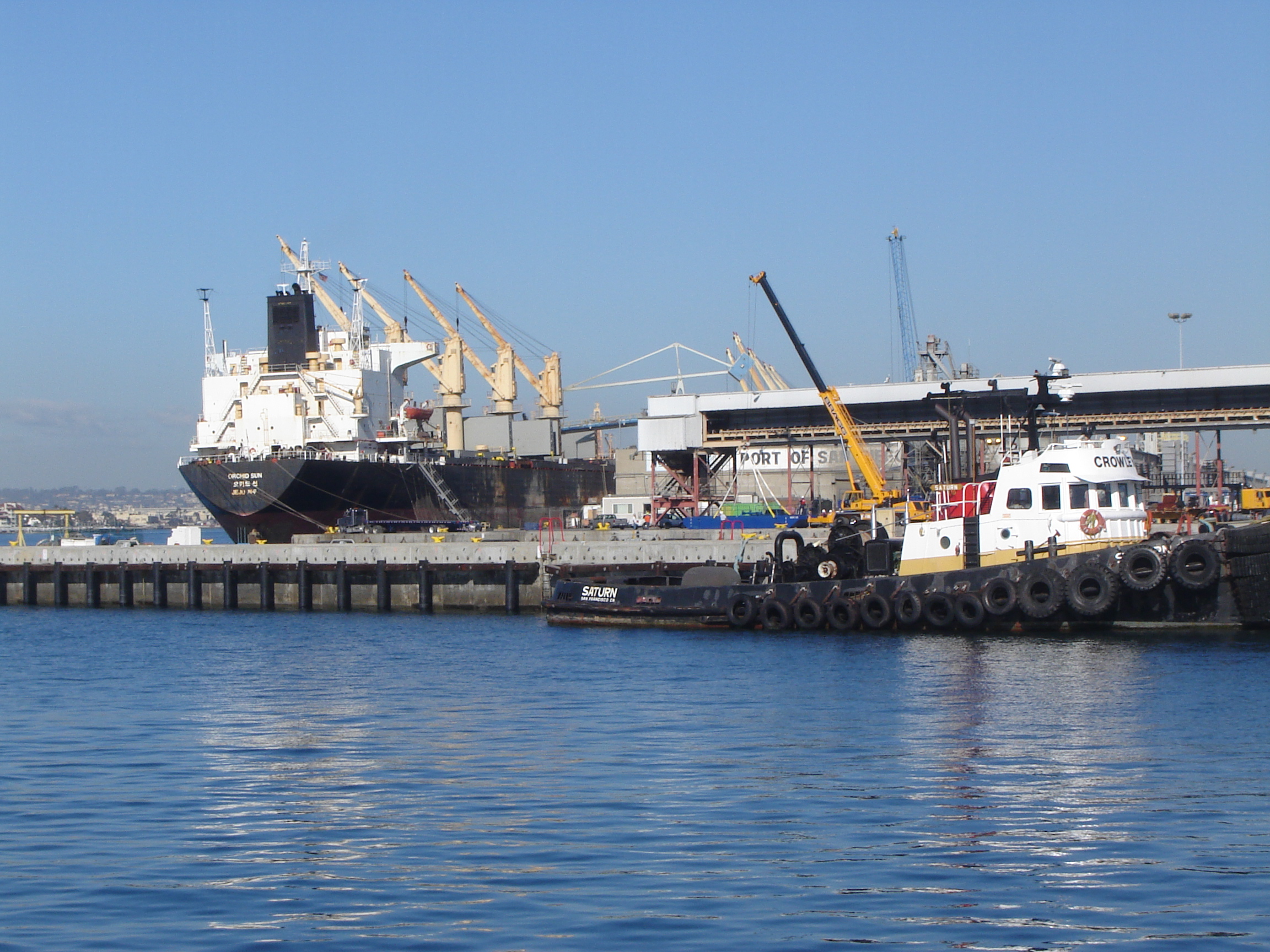 The San Diego Unified Port District maintains two marine terminals: the 140 acre National City Marine Terminal and the 96 acre Tenth Avenue Marine Terminal in Barrio Logan. These terminals handle a variety of products including fruit, automobiles, lumber, and windmill components.
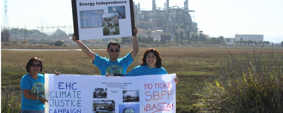 From 1960 until decommissioned in 2010, the South Bay Power Plant’s four generators polluted South San Diego Bay and emitted tons of toxic and greenhouse gases.
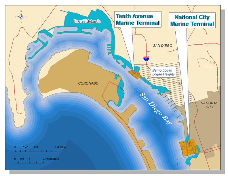 The San Diego Unified Port District was created by state legislation in 1962 to promote commerce, navigation, recreation and fisheries for most of the tidelands in the five cities around
  History of San Diego Bay
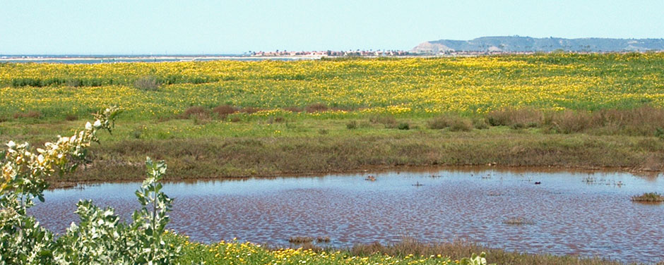
 Most of the land surrounding San Diego Bay is controlled by the San Diego Unified Port District or the U.S. military. The last remaining piece of privately owned bayfront property was 125 acres between the Sweetwater Marsh Unit of the San Diego National Wildlife Refuge and a marina/commercial development on Port controlled land to the South. When developers proposed dense commercial and residential development at this site, environmentalists and South Bay residents objected.