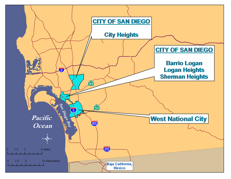
Emergency EHC Work Areas map NoChulaVista  for website 2012

La mayoría del trabajo de la Environmental Health Coalition apoya a residentes de comunidades de bajo ingreso y de color en zonas urbanas del condado de San Diego y en comunidades cerca de la bahía de San Diego. La mayor parte de la gente que vive en las comunidades de Barrio Logan, Sherman/Logan Heights, y City Heights de la ciudad de San Diego, y la parte oeste de la ciudad de National City, es latina. Estos residentes inmigraron de Latinoamérica, Asia y África y muchos tienen pocos estudios.

Los problemas en estas comunidades comúnmente suceden en muchas comunidades de bajo ingreso y de color: viviendas de calidad inferior, escuelas con sobre cupo, falta de servicios sociales, trabajos mal pagados, industrias contaminantes mezcladas con sitios residenciales y comerciales, transito de camiones industriales, falta de parques y tiendas de comida saludable, contaminación del aire severa y contaminación por plomo en vivienda vieja.

NationalCity24thStPier

Todas las comunidades de enfoque de la EHC se desarrollaron durante el mismo tiempo en la historia de San Diego, a finales de 1860 – 80, y pasaron por transiciones parecidas. Las esperanzas de que las vías férreas conectaran a San Diego con puntos del este aumentaron y disminuyeron al igual que el valor del mercado de bienes raíces y la economía. La primera parte de nuestra región que se desarrolló fue lo que ahora se conoce como el centro de San Diego y a finales de 1880, las comunidades aledañas de Logan Heights (la cual incluye el Barrio Logan) y Sherman Hieghts se subdividieron. El transporte público a estos barrios y hacia City Heights permitió que la población creciera. Los barrios de Logan Heights y Sherman Heights eran de clase social alta; City Heights era barrio de la clase trabajadora. La ciudad de National City es la segunda ciudad más vieja del condado de San Diego y se desarrolló casi al mismo tiempo y también fue impulsada por las esperanzas de las vías férreas. Su desarrollo fue como un centro de la agricultura e industria abarcando las gamas económicas y étnicas.

Las carreteras mejoradas y la introducción del automóvil permitieron que muchos residentes más ricos se mudaran a las afueras de la ciudad, y Logan Hieghts y Sherman Heights se convirtieron en barrios de las olas sucesivas de inmigrantes y minorías quienes fueron excluidos de nuevos barrios por discriminación racial, étnica y religiosa: irlandeses, judíos, japoneses, chinos, afro americanos y latinos. Después de la segunda guerra mundial, la ciudad de National City se convirtió en hogar de la población filipina. Después de la guerra de Vietnam, City Heights fue la primera parada para muchos refugiados del sudeste de Asia y hogar de refugiados más recientes después de las luchas internas en sus países de origen.

Factores comunes que contribuyeron a la decadencia de cada uno de estos barrios incluyen:

  • La construcción de carreteras y autopistas
  • Aumento de la densidad de la población
  • Propietarios ausentes y el deterioro de las viviendas
  • Aumento de la industrialización
  • Cambios de la zonificación
  • Guerras y el inicio de San Diego como un centro militar

La Importancia del Lugar

Según la investigación que llevó acabo The California Endowment, el código postal en el que uno reside es un indicador fiable de la expectativa de vida. Un hilo común en todo el trabajo de la EHC, es el reconocimiento de los impactos acumulativos de las vulnerabilidades ambientales, sociales, políticas y económicas que afectan la calidad de vida en nuestras comunidades de enfoque. La siguiente grafica usa datos del 2010 Census and American Community Survey (2005-2009) para comparar algunos de estos factores en las zonas de enfoque de la EHC con todo el condado de San Diego:

Para más información acerca de cada uno de estos barrios, use la barra de menú de la izquierda.

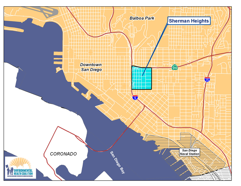
ShermanHeights website map May 2012EHC's current efforts in Sherman Heights

Community Planning – assist the Historic Logan neighborhoods of Sherman Heights, Grant Hill, Stockton, Logan Heights and Memorial develop a vision for the Commercial/Imperial Corridor as a vibrant community link

Healthy Kids – reduce lead poisoning and asthma associated with poor housing and air pollution 

Green Energy/Green Jobs – improve the housing stock through energy efficiency and installation of solar energy and create green jobs for community residents 

History

Sherman Heights is one of the oldest residential communities in the City of San Diego, being first subdivided in 1869. Its original boundaries went from Market Street to the north, 15th Street to the west, 25th Street to the east, and Commercial Street to the South.

The original settlers of Sherman Heights represented diverse economic groups, but as the wealthier residents left, Sherman Heights became home to racial, ethnic and religious groups restricted from the newer developments. In the early 1900's it was home to German, Irish and Jewish immigrants; in 1920s, it became home to Japanese and Chinese immigrants; through the 1940s it was a thriving middle class neighborhood.

Highway construction from the 1940's into the 1960's (State Route 94 and Interstate Highway 5) and the subsequent adoption of the 1987 Southeastern San Diego Community Plan redrew the boundaries. SR 94 became the northern boundary, I-5 the western boundary, and Imperial Avenue the southern boundary. The original 160 acres was reduced to about 140 acres.
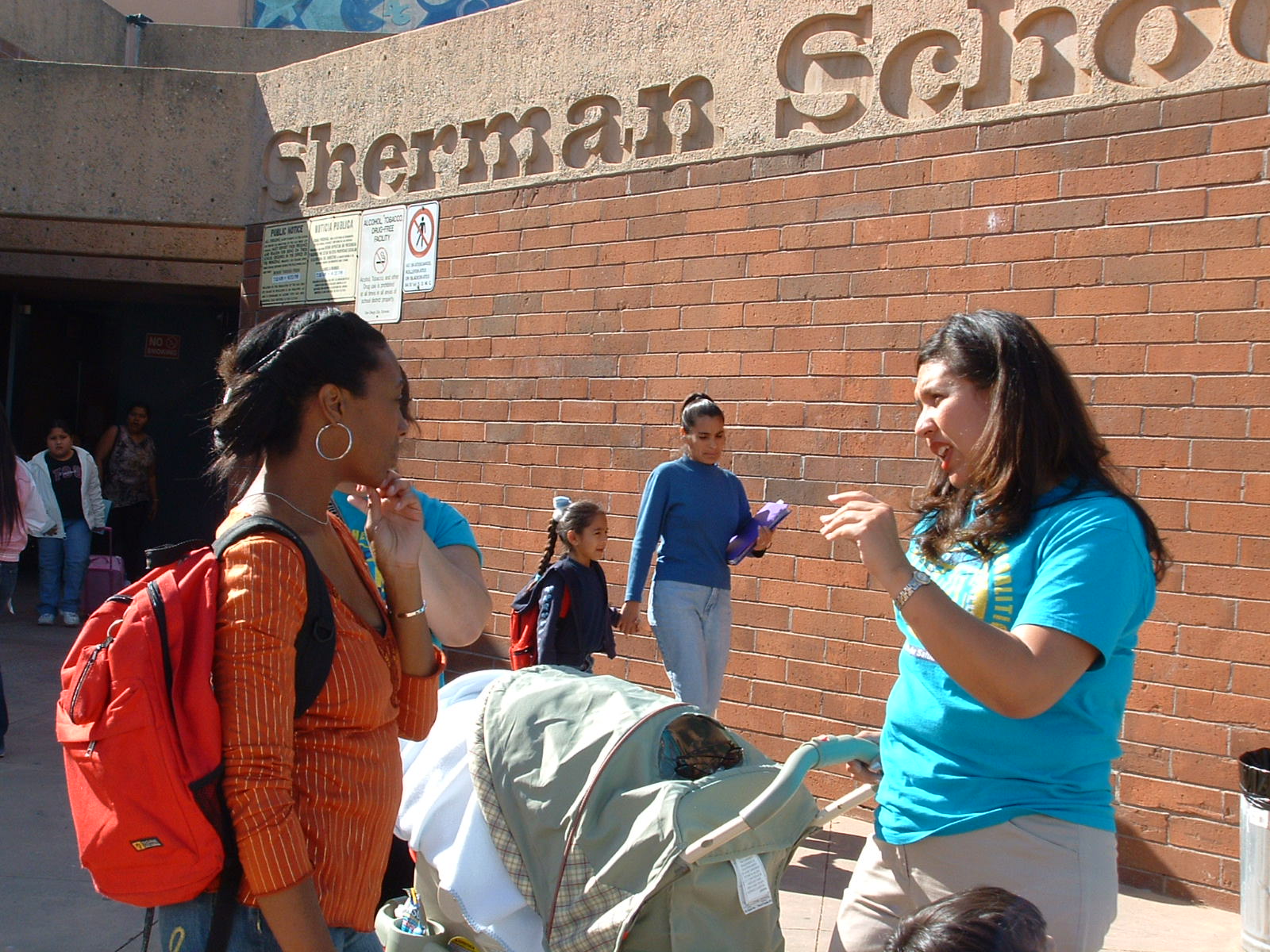
ShermanSchoolFrom 1950-1970 Sherman Heights was predominantly African American, and since the 1970's it has been mainly Latino. The proximity of Sherman Heights to the recently redeveloped East Village has increased rents, and many of the older homes that were divided into apartments are being reconverted to single family homes. This is forcing low-income residents to areas of lower rent such as City Heights. In the 2010 census, Sherman Heights was one of the few communities to become less "non-white."

Although much of the original housing stock remains, over the years many single-family homes were converted to apartments and second homes built in the rear yards. Home ownership declined and absentee landlords allowed the housing to deteriorate. Vacant land next to the freeways attracted criminal activity, and the 1970's and 80's were a bleak period.

The Southeastern San Diego Community planning area originally included more than 7000 acres, including all of the communities recognized as part of the Historic Logan Area except for Barrio Logan. Because the planning area is so large, many of the communities have developed individual plans. The Sherman Heights Revitalization Plan was adopted in 1995, and included the commercial corridors along 26th Street to the east and Commercial Street to the south. The Commercial/Imperial Corridor connects the Sherman Heights, Grant Hill and Stockton communities to the Logan Heights and Memorial neighborhoods to the south. Imperial Avenue is mainly mixed-use commercial while Commercial is zoned industrial. A new Corridor Plan was initiated in 2011 to develop a new 20 year vision.

Environmental Racism

Environmental racism is not easily defined but easy to recognize; it is the cumulative impacts of environmental, social, political and economic vulnerabilities that affect the quality of life of a community.

Demographics

Area  2010 Population   Non-White   Under 18   18 and Older   Families in Poverty   Renter Households 
 Sherman Heights  1,858 81% 22% 78% 36% 87%

Pollution Burden

Sherman Heights is primarily a residential neighborhood, except for the Imperial/Commercial Corridor. Imperial Avenue is mostly commercial, while Commercial is light industrial. The pollution burden of Sherman Heights comes from the industries along Commercial Avenue, illegal auto-repair/body-repair shops in the residential area, its proximity to the freeways and the deteriorated quality of its housing.

EPA Respiratory Risk data from 2005 show that Sherman Heights residents experience a 5-6 times greater risk than a neighborhood considered "safe." Total cancer risk from air contaminants is among the highest in the County.

Sherman Heights has been identified as a "hot spot" for childhood lead poisoning due to the age and poor condition of its housing and the large number of children under the age of 6. Much of original housing was built in the early 1900's when levels of lead in paint were highest.

EHC's History/Successes in Sherman Heights

Read about EHC's City Heights Leadership Team and Community Action Team.
The majority of EHC's work supports residents in low-income communities of color in urban areas of San Diego County and the communities around San Diego Bay. These are the largely Latino communities of Barrio Logan, Logan Heights, Sherman Heights and City Heights in the City of San Diego, and Old Town (also known as Westside) in National City. Many residents are immigrants from Latin America, Asia and Africa, and many have little formal education.

Problems in these communities are common to many low-income communities of color: substandard housing, over-crowded schools, a lack of social services, low-paying jobs, polluting industries mixed in with residential and commercial sites, industrial truck traffic, lack of parks and healthy food outlets, severe air pollution and lead contamination in aging housing stock.

(Click here for a brief history of San Diego's target communities) All of EHC's target communities developed around the same time in San Diego's history, the late 1860-80's, and went through similar transitions. Hopes of a railroad line connecting San Diego to points east rose and fell, and with these hopes land speculation was followed by financial crashes. What is now downtown San Diego was developed first, and by the late 1880's, the adjacent communities of Logan Heights (which then included Barrio Logan) and Sherman Heights were subdivided. Public transportation to these neighborhoods and out to City Heights allowed the population to grow. Logan Heights and Sherman Heights were upper class neighborhoods; City Heights was a working class neighborhood.

National City, San Diego County's second oldest city, developed around the same time, again driven by hopes of a railroad. It developed as an agricultural and industrial hub, with a population spanning the economic and ethnic spectrums.

Improved roads and the introduction of the automobile allowed many of the wealthier residents to move to new suburbs, and Logan Heights and Sherman Heights became home to successive waves of immigrants and minorities who were excluded from living in the new neighborhoods by racial, ethnic, and religious discrimination: Irish, Jews, Japanese, Chinese, African Americans, and Latinos. After World War II, National City became home to a large Filipino population. City Heights was the first home of many Southeast Asian refugees following the Vietnam War and home to many other more recent refugees following civil strife in their homelands.

Common factors that contributed to the decline of each neighborhood were:

• The construction of highways and freeways

• Increased population density

• Absentee landlords and the deterioration of the housing stock

• Increased industrialization

• Zoning changes

• Wars and the rise of San Diego as a military center

Place matters. According to research conducted by The California Endowment, one's zip code is a reliable predictor of life expectancy. A common thread in all of EHC's work is the recognition of the cumulative impacts of environmental, social, political and economic vulnerabilities that affect the quality of life in our target communities.

The following chart uses 2010 Census and American Community Survey (2009-2013) data to com¬pare some of these factors in EHC target areas to the County of San Diego as a whole:

CommunityPeople of ColorFamilies in PovertyRentersPopulation < 18 years old
Logan Area

97% 39% 75% 33%
Westside National City 94% 29% 77% 28%
National City (total) 90% 25% 66% 25%
City Heights 90% 26% 80% 32%
Combined EHC Target Area 90% 32% 80% 32%
San Diego County 52% 14% 46%  23%

For more information on each of these neighborhoods, click on the map or use the menu bar at the left.

(Eventually, the map will be clickable - Click on the map to learn more about each community.)

CommunityPeople of ColorFamilies in PovertyRentersPopulation < 18 years old
Logan Area

97% 39% 75% 33%
Westside National City 94% 29% 77% 28%
National City (total) 90% 25% 66% 25%
City Heights 90% 26% 80% 32%
Combined EHC Target Area 90% 32% 80% 32%
San Diego County 52% 14% 46%  

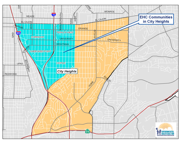
The current boundaries of City Heights were created by the 1998 Mid-City Communities Plan. Environmental Health Coalition works primarily in the Corridor, Teralta West, Cherokee Point and Castle neighborhoods, the neighborhoods most impacted by the freeways and the businesses along El Cajon Boulevard and University Avenue.

CityHeights website map May 2012

EHC's current efforts in City Heights

Community Planning – help community residents create a sustainable City Heights which is safe, healthy and affordable

Healthy Kids – reduce lead poisoning and asthma associated with poor housing and air pollution

Green Energy/Green Jobs – improve the housing stock through energy efficiency and installation of solar energy and create green jobs for community residents 

History

In 1880, 240 acres of land were purchased by developers and named City Heights because of its 360 degree expansive views. The highest neighborhood was called Teralta. Although an electric trolley line connected the new community with downtown, growth was slow. The 1910 census showed only about 400 residents in City Heights.

Anticipation of the 1915 Panama-Pacific Exhibition in San Diego spurred growth, and by 1912 the 4,000 residents of City Heights voted to incorporate as a separate city called East San Diego. The city prided itself on its high moral character (no liquor stores, gambling or dance halls, no gun totting). A 1918 advertisement described City Heights as the home of the working men of San Diego; 8 out of 10 families owned their home. Thriving commercial development grew up along University Avenue and El Cajon Boulevard.

Soon the new city experienced problems: unavailability of a reliable supply of water; the trolley line operators threatened to discontinue service; the City of San Diego decided to greatly increase the cost for providing high school education for East San Diegans. In 1923, residents voted to become part of San Diego and this was finalized in 1924.

Zoning problems

City Heights continued to grow and prosper as a mostly white, middle class community until the College Grove shopping mall was completed in 1959. This began a rapid decline in business along University Avenue and El Cajon Boulevard, and failing business owners believed they could stave off bankruptcy by increasing the population density. The 1965 Mid-City Development Plan rezoned most of the area for multi-family dwelling units. Developers began tearing down single-family homes and putting up small, cheaply constructed apartment buildings known as "six-packs." In 1950, only 9% of housing in City Heights was multi-family units; by 1970 it was 31%; it is currently more than 60%.

As the housing density increased, the demographics shifted. Following the end of the Vietnam War in 1974 City Heights became home to many Southeast Asian refugees. This was followed by waves of other refugees fleeing violence in their homelands: Ethnic Albanians from Kosovo, Central Americans, East Africans, and Kurds. African-Americans and Latinos also moved to City Heights as rents in other parts of the City escalated, often due to gentrification. More than 30 languages and 80 dialects are now spoken in City Heights.

The 1970s and 80s saw sharp increases in crime, and the 1984 Mid-City Community Plan identified the increased multi-family residential housing with reduced resident ownership and deterioration of residential housing stock as major problems. In 1990, crime was so bad that the City declared a State of Emergency in City Heights.

Highway related problems

In 1932, City Heights welcomed the construction of the Fairmount/Murphy Canyon highway that connected communities to the north and south of Mission Valley, and extended all the way to Mexico. Interstate 805 was also seen as a boon to community access when it was built in the 1960s.

But the planned expansion of Interstate 15 that had been contemplated since the late 1950s was another issue. There were several starts and stops in the 1970s and CalTrans purchased hundreds of homes in anticipation of constructions. Instead of tearing them down, the houses were boarded up and became hangouts for drug users and prostitution.

Rebuilding

Several community non-profit groups formed in response to the decline in City Heights including the City Heights Community Development Corporation in 1981 and Mid-City Community Advocacy Network (Mid-City CAN) in the late 1980s. The CHCDC worked with residents in 1991 to develop a vision for the I-15 corridor – they supported a covered freeway to prevent neighborhoods from being torn apart and the loss of a significant area of land. As one resident said, she didn't want "a divisive slash through my community, a hole with cars in it." Covering the entire portion of I-15 through City Heights proved to be cost prohibitive. When I-15 was completed in 1999 only University Avenue and El Cajon Boulevard were widened over the freeway to accommodate bus stops and a park was built over the freeway between Orange and Polk Avenues close to Central Elementary School.

When the last supermarket serving City Heights announced in 1994 that it was leaving, Philanthropist Sol Price became involved. The City Heights Initiative was formed between Price Charities and public agencies and non-profit organizations. A new library/recreation/educational complex was built, along with a six story office building, hundreds of affordable housing units and La Maestra Community Health Clinic (a Gold Medal LEED certified building).

In 2010 The California Endowment included City Heights in its Building Healthy Communities initiative. The local collaboration is led by Mid-City CAN; EHC leads the Built Environment team that includes City Heights Community Development Corporation, Proyecto Casas Saludadbles, and the International Rescue Committee.

Environmental Racism

Environmental racism is not easily defined but easy to recognize; it is the cumulative impacts of environmental, social, political and economic vulnerabilities that affect the quality of life of a community.

Demographics

Area  2010 Population   Non-White   Under 18   18 and Older   Families in Poverty   Renter Households 
 City Heights  18,482 90% 32% 68% 32% 87%

Pollution Burden

City Heights has never had much industrial activity. Almost all of the Hazardous Materials Management and Air permits are for auto-related businesses and other small facilities that line much of University Avenue and El Cajon Blvd. Its pollution burden comes from its proximity to the freeways and the deteriorated quality of its housing.

Asthma hospitalization rates in 2009 for children ages 0-17 were 162/100,000 in City Heights compared to 107/100,000 for San Diego County as a whole. EPA Respiratory Risk data from 2009 show that City Heights residents experience a 4-5 times greater risk than a neighborhood considered "safe."

City Heights has been identified as a "hot spot" for childhood lead poisoning due to the age and poor condition of its housing and the large number of children under the age of 6. Most of City Heights original housing was built from 1910-1930 when levels of lead in paint were highest; the apartment boom of the 1960's and 1970's took place before lead was completely banned in household paint in 1978.

EHC's History/Successes in City Heights

  • Blood Lead Level Testing. In October 2010 EHC sponsored a blood lead level testing at Cherokee Point Elementary School.
  • Leader Development.

Relationships to other EHC Efforts

Regional Transportation Planning: Lack of adequate public transportation, congested surface streets, and increased freeway traffic are concerns for City Heights residents.

San Diego Bay: Chollas Creek runs through part of City Heights on its way to San Diego Bay.

Goods Movement (Port of San Diego and Border Ports of Entry): Interstate 805 is the major truck route for freight truck coming across the U.S./Mexico Border Port of Entry at Otay Mesa and from the Port District's Marine Terminal in National City. Interstate 15 was not intended as a major truck route, but is experiencing increased truck traffic.

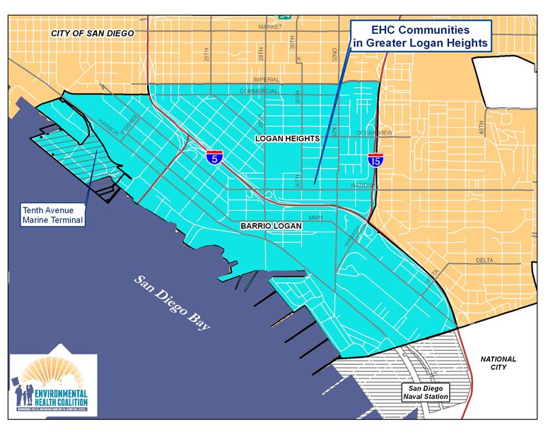
The Historic Barrio District area includes the communities of Logan Heights, Memorial, Sherman Heights, Grant Hill and Stockton; the historic Logan Heights area also included Barrio Logan. Environmental Health Coalition works throughout the Logan area, but especially in Barrio Logan.

Barrio Logan LoganHts Map

History

Logan Heights/Barrio Logan is a microcosm of environmental racism. You can find it all here:

  • A community of color created by racially discriminatory real estate covenants,
  • Overcrowding, as more and more people are restricted to a small area,
  • Encroachment of industry into residential areas,
  • Effects of war and economic downturns on immigrant communities,
  • Destructive effects of highways and bridges,
  • Failure of government to provide services, provide protective zoning, and keep their promises, and ultimately
  • The conversion of a once vibrant community into a land of junkyards, poverty, and substandard housing.

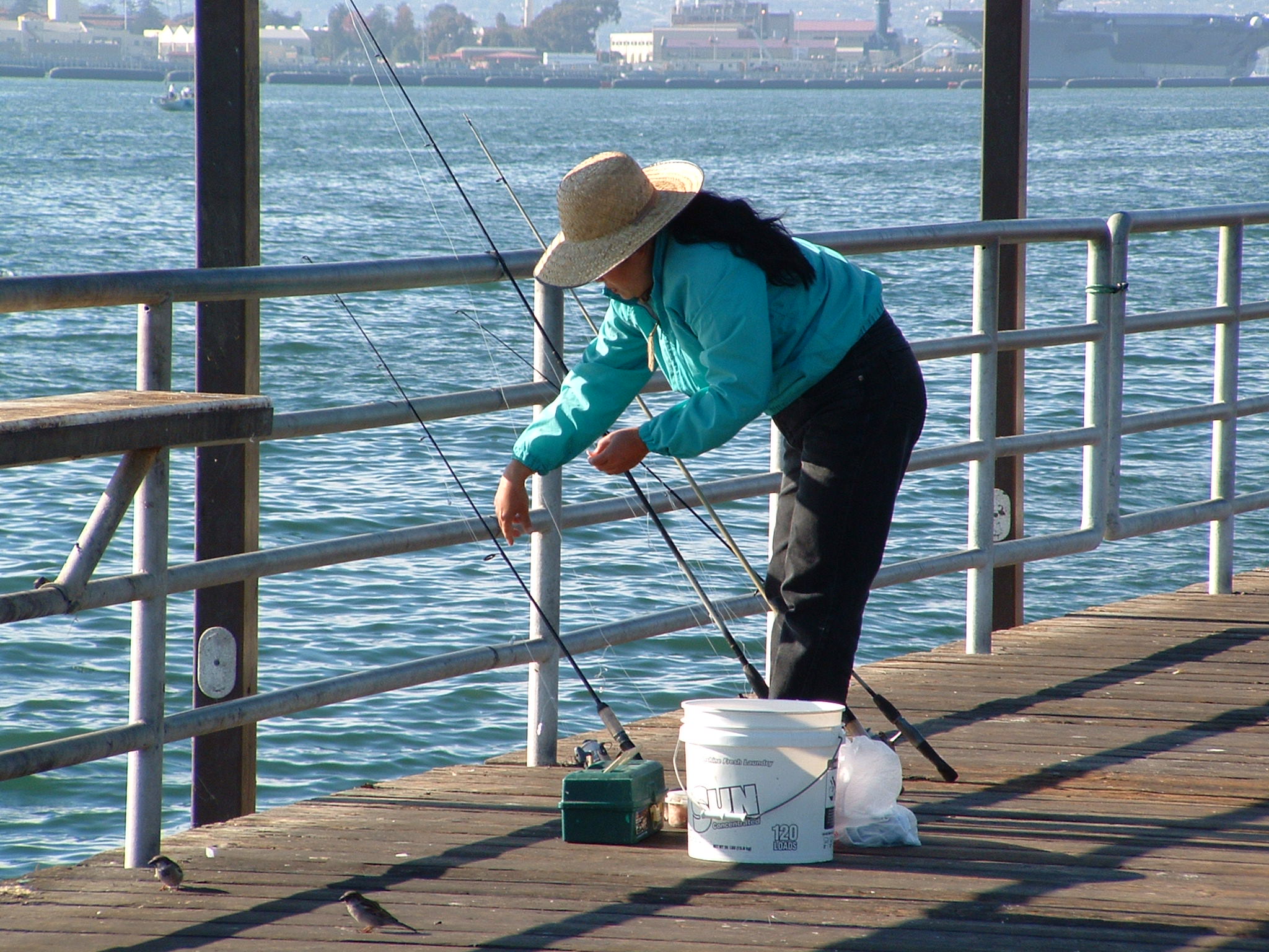
best fisherphoto

Much of this transformation took place from the 1920s to 1950s, but the community was physically torn apart in the 60s. In 1963, Interstate 5 was built through the middle of Logan Heights – the area to the northeast of the freeway retained the name of Logan Heights, while the area to the southwest became known as Barrio Logan. In 1967, the Coronado Bridge was built, dissecting the new area of Barrio Logan. Thousands of homes were destroyed and families displaced by these events.

But this period also sparked the birth of San Diego Chicano Park.

When land that was promised as a park under the bridge was instead to be turned into a highway patrol station, people revolted. Eventually Chicano Park was created and is now home to world famous murals, a free health clinic was established, many of the junkyards were eliminated, and in 1978 the Barrio Logan/Harbor 101 Community Plan was adopted.

Click here for a more detailed history of the area

Demographics

Area  2010 Population   Non-White   Under 18   18 and Older   Families in Poverty   Renter Households 
 Barrio Logan            4,890  85%  26%  74%
 Logan Heights                         14,196  95%  34%  65%  30%  70%

Environmental Racism

Environmental racism is not easily defined; it is the cumulative impacts of environmental, social, political and economic vulnerabilities that affect the quality of life of a community.

The Barrio Logan Community Plan Update

For the first time in 30 years, residents of Barrio Logan proposed the first update to their community plan. Click here to learn more about our current efforts

In Barrio Logan, EHC works on:

Community Planning

Children's Health

Green Energy/Green Jobs

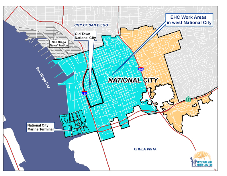
National City map for website

Environmental Health Coalition's current efforts in National City

Community Planning – implementation of the Westside Specific Plan and relocation of polluting industries; development of affordable housing 

Healthy Kids – reduce asthma and other illnesses associated with poor housing and air pollution 

Green Energy/Green Jobs – improve the housing stock through energy efficiency and installation of solar energy and create green jobs for community residents 

History

National City is the second oldest city in San Diego County. Its modern history started in 1868 when Rancho de la Nación was purchased by the Kimball brothers. Hopes of a railroad spurred population growth, but when it didn't materialized the population dropped from 5,000 to 1,500 in 1873. Growth was slow, and based largely on agriculture. The transcontinental terminus of the Santa Fe Railroad was built in 1885 and the City was incorporated in 1887.

The Westside area, also known as Old Town, is an area bordered on the west by Interstate 5 and the east by Roosevelt Avenue stretching from W. Plaza Boulevard south to W. 24th Street. During the early development of National City, small single family homes were constructed in Old Town. Many of these early homes constructed around the turn of the century still remain. After World War II, to encourage economic development, industrial uses were permitted in the area.

In an interest to resolve the conflicting land uses, the community encouraged the City to develop the Westside Specific Plan. The Council embarked on the preparation of the Westside Specific Plan in 2005 to comprehensively address environmental and land use issues, leading to this plan that reflects residents' aspirations for their community. This Specific Plan was prepared to address concerns of the impact of incompatible land uses expressed by the community at numerous City Council meetings and at several community workshops.

Environmental Racism

Environmental racism is not easily defined but easy to recognize; it is the cumulative impacts of environmental, social, political and economic vulnerabilities that affect the quality of life of a community.

Demographics

Area  2010 Population   Non-White   Under 18   18 and Older   Families in Poverty   Renter Households 
 National City  39,831 88% 26% 74% 23% 76%


Pollution Burden

According to the San Diego County Department of Environmental Health, National City is currently home to 32 million pounds of hazardous substances and 870,000 cubic feet of toxic or hazardous gases. Just the top 10 polluters release 150,000 lbs. of toxic or smog forming air pollutants per year. In comparison, La Jolla has 3.8 million pounds of hazardous gases. 

National City asthma hospitalization rates in 2010 for children ages 0-17 were 122/100,000 compared to a countywide rate of 87.


EHC's History/Successes in National City

  • Westside Specific Plan Ordinance (changing the zoning) passed: August 3, 2010 
  • Westside Specific Plan passed: March 2010

View these documents on National City's website

Green Zones are designed for places like National City that face a deadly combination of public health burdens, environmental degradation, and socioeconomic stressors. We seek to transform these areas into healthy, thriving "Green Zones" by creating proactive, solution-oriented, community and interagency partnerships. Working together, we will target public and private resources and programs into Green Zone areas to support implementation of community-based solutions developed through intensive resident engagement and leadership.

The California Environmental Justice Alliance (CEJA) (a statewide coalition of six community-based organizations) has launched a California-wide Green Zones Initiative, with sites in Los Angeles, Riverside, Southern San Joaquin Valley, Oakland, Richmond and San Francisco. Environmental Health Coalition anchors the San Diego Green Zones effort and has selected Old Town National City as its Green Zone Pilot.

Old Town National City: Now a "Brown Zone"

The Old Town neighborhood of National City is plagued by decades of poor land-use planning, which has left an unhealthy mix of homes, toxic industries, and warehouses, compounded by a lack of affordable housing and open space. There are over 34 autobody shops in a 90 block area, releasing an estimated 23,000 tons of air toxins. The area is bordered by Interstate 5 and home to a diesel bus station, both of which contribute to high levels of particulate matter. As a result, residents face a range of "cumulative impacts:"

• 20% of housing units are overcrowded, with 2 or more people per room.

• 14% of children have diagnosed asthma, twice the average rate in California

• 94% are people of color

• 41% of families live in poverty

• 75 % of the population are renters.

Mapping Cumulative Impacts with the Environmental Justice Screening Methodology)

The Environmental Justice Screening Methodology (EJSM) is a tool to identify what areas face a combination of environmental and socioeconomic stressors, or "cumulative impacts." It has been developed by Rachel Morello-Frosch (UC Berkeley), Manuel Pastor (University of Southern CA), and Jim Sadd (Occidental College). The EJSM creates and maps a "cumulative impact" score for census tracts. The methodology combines indicators from publicly-available data on:

• public health and air quality

• land use data

• the number of hazardous facilities and sensitive receptors in an area

• socioeconomic vulnerabilities

The scores range from 3 - 15, with 15 being "highly impacted."

Census Tracks in Old Town National City have an EJSM score of 13 and 14, meaning it is highly impacted.

What does a National City Green Zone look like?

Relocating unhealthy land-uses: In 2010 National City began the amortization/phase out process of incompatible land uses, such as autobody shops, away from residential areas. National City is now determining the order in which the non-conforming land-uses will be amortized, with the process set to start in early 2012.

Create a green industrial park: Businesses relocated under the amortization process would move to an industrial area a few miles west of the residential neighborhood. The park would serve a hub for the paint and auto-body industry and foster green practices.

Affordable housing transit-oriented development: 14 acres of land adjacent to the light rail Trolley Stop will be cleaned up and developed into 201 affordable housing units. The site has been chosen by EPA as part of the Partnership for Sustainable Communities Brownfields Pilots.

Paradise Creek Educational Open Park Space: Community residents have been working to restore this salt marsh wetland that flows from San Diego Bay into the city since 1993. The 2 acre park is the only park serving a community of about 1600 people and passes by the local elementary school. The first phase of the interpretive park opened in 2007 after 12 years of planning and fundraising.

Subcategorías

The "Historic Logan Heights" area includes the communities of Logan Heights, Barrio Logan, Memorial, Sherman Heights, Grant Hill, Stockton, Southcrest and Shelltown. Environmental Health Coalition works throughout this area, but especially in Barrio Logan, Logan Heights and Sherman Heights.

(insert map showing Historic Logan Heights communities with communities identified and major freeways)

History:

Historic Logan Heights is a microcosm of environmental racism in the United States. You can find it all here:

• A community of color created by racially discriminatory real estate covenants,

• Overcrowding, as more and more people are restricted to a small area,

• Encroachment of industry into residential areas,

• Effects of war and economic downturns on immigrant communities,

• Destructive effects of highways and bridges,

• Failure of government to provide services, provide protective zoning, and keep their promises, and ultimately

• The conversion of once vibrant communities into a land of junkyards, poverty, and substandard housing.

Much of this transformation took place from the 1920's to 1950's, but the community was physically torn apart in the 60's. In 1963, Interstate 5 was built through the middle of Logan Heights – the area to the northeast of the freeway retained the name of Logan Heights, while the area to the southwest became known as Barrio Logan. In 1967, the Coronado Bridge was built, dissecting the new area of Barrio Logan. Thousands of homes were destroyed and families displaced by these events.

But this period also sparked the birth of Barrio Logan. When land that was promised as a park under the bridge was instead slated to be turned into a CalTrans workyard, people revolted. Eventually Chicano Park was created and is now home to world famous murals, a free health clinic was established, many of the junkyards were eliminated, and in 1978 the Barrio Logan/Harbor 101 Community Plan was adopted.

Click here for a more detailed history of the area. (Link to Historical Resources Survey, Barrio Logan Community Plan Area)

For more information on each community and EHC's past and current work, click on the map or community name.

Demographics of Logan Area:

Environmental racism is not easily defined; it is the cumulative impacts of environmental, social, political and economic vulnerabilities that affect the quality of life of a community.

Insert chart for Barrio Logan, Logan Heights, Memorial, Sherman Heights, Grant Hill, Stockton, Southcrest, Shelltown: %people of color, %poverty, %children under 6 and 18, median age of housing, %immigrants, %Spanish spoken at home, %with high school degree of less

Pollution burden: